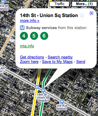
To use it, view New York City in Google Maps and then click the “More” option and select Transit.
Zoom in and you’ll see individual station icons. Click on an icon to get more information about that station.
Mobile devices that have access to layers on Google Maps will be able to access the subway maps. Those devices include BlackBerry, Windows Mobile, and Symbian S60.
Local marketing is a huge topic and there’s a lot to do here but one fundamental task to start working on first is building your organic search presence
Consumers are most likely to search for a local business on Google or Yelp and pick a winner based on those reviews and ratings. Helping pointers on dealing with positive and negative reviews, and how they can boost your business' local ranking.
We use cookies to understand how our site is used and to improve it. Cookie policy