

When you’re traipsing around the earth via Google Maps, you now have a new option to get a little closer. Google is incorporating photographs from Panoramio, a travel photo sharing site, to assist with Street View zoom.
Let’s say, for example, that you’re checking out the Eiffel Tower in Street View from Avenue de la Motte Picquet. To access the new feature, click the user photos box in the top right corner (yes, this was added back in February, hold your horses, I’m getting to the new stuff.)

Once you’ve done that, check out the shapes on the image of the Eiffel Tower. (Or click one of the images in the carousel.)
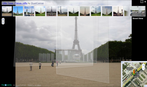
Mouseover one of the polygons to select an image to view. Then, double-click to actually view it.

The new image shows a zoomed in look at the area you selected:

Then you can select yet another polygon on the new image:

And see yet another image that’s zoomed in a little more:

You can keep doing this until you’re as zoomed in as Panoramio photos provide.
What do you think of this new Google Maps zoom feature? Let us know by zooming below to leave us your comment.